Day trips are a great way to appreciate the wonders of what’s close to home.
The Plan
Whitewater State Park is a park that we’ve heard a lot about from friends and co-workers as a place we should try to camp. Unfortunately, it’s campgrounds are booked solid through October unless you want to do some mid-week camping (which is actually the way to do it if you want peace and quiet). The fact that it’s popular isn’t a surprise, it’s less than two hour drive from Minneapolis-St Paul making it a do-able day-trip.
With the pandemic in full swing, the amount of things we’ve done with friends can probably be counted on two hands, possibly one. We called up our long lost next-door neighbors that love the outdoors and deemed hiking a relatively safe way for us to hang out at long last.
I’m a pretty big fan of All Trails as a way to find cool places to hike, by checking out other people’s photos, distance, difficultly and elevation change. We thought following sounded nice…
Whitewater State Park Dakota Trails Loop is a 3.9 mile moderately trafficked loop trail located near Altura, Minnesota that features a lake and is rated as moderate. The trail offers a number of activity options and is best used from May until October. Dogs are also able to use this trail but must be kept on leash.
The plan was:
- Eat breakfast & pack a lunch
- Leave at 8:30am
- Arrive around 10:30am
- Hike to a cool location & eat
- Finish the hike in 3hrs
The Actual
As you can see things don’t always go as planned… The morning started off just fine with packing at 7:30am but some how time just flies and by the time we hit the road it was almost 9am. Driving proved a bit more challenging with a major highway closure in the metro but more interestingly was the road closure in the middle of no-where Minnesota… No worries we thought until we realized Google was not rerouting… turns out no-where Minnesota has no service! Being a child of the midwest, we were able to circumvent the closure by relying on the country roads being roughly laid out in a grid. The next road however was gravel, not something I was hoping to take my VW GTI on!
With the rest of the drive being uneventful we arrived at about 11am. We were lucky that we immediately met up with our friends at the Visitor Center. No service would have made that hard, had we not. Speaking of no cell service, that means no maps on your phone. All Trails does have a subscription plan that allows you to download maps for offline use but these days I feel like I’m drowning in subscription fees and forewent the $2.50/mo fee by being clever and having the map loaded already in my phone. We grabbed a few paper maps from the ranger to be safe, it’s never a good idea to fully rely on electronics in the wilderness.
With that we were ready to hit the trail! Then we saw this:
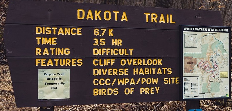
Difficult… 3.5hrs (not the 2hrs we had already padded to 3). Hmm…
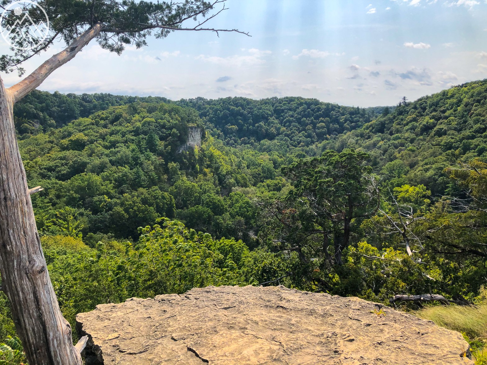
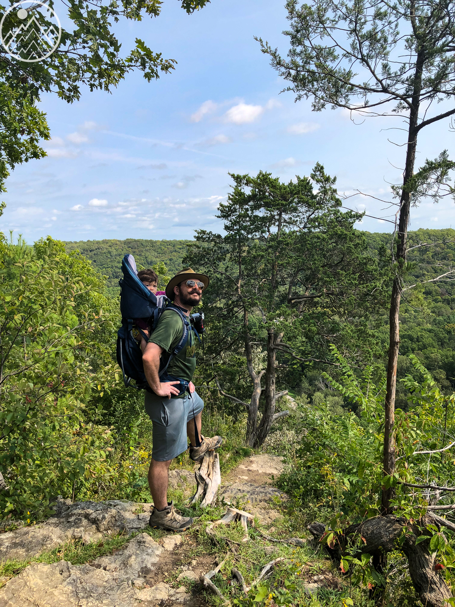
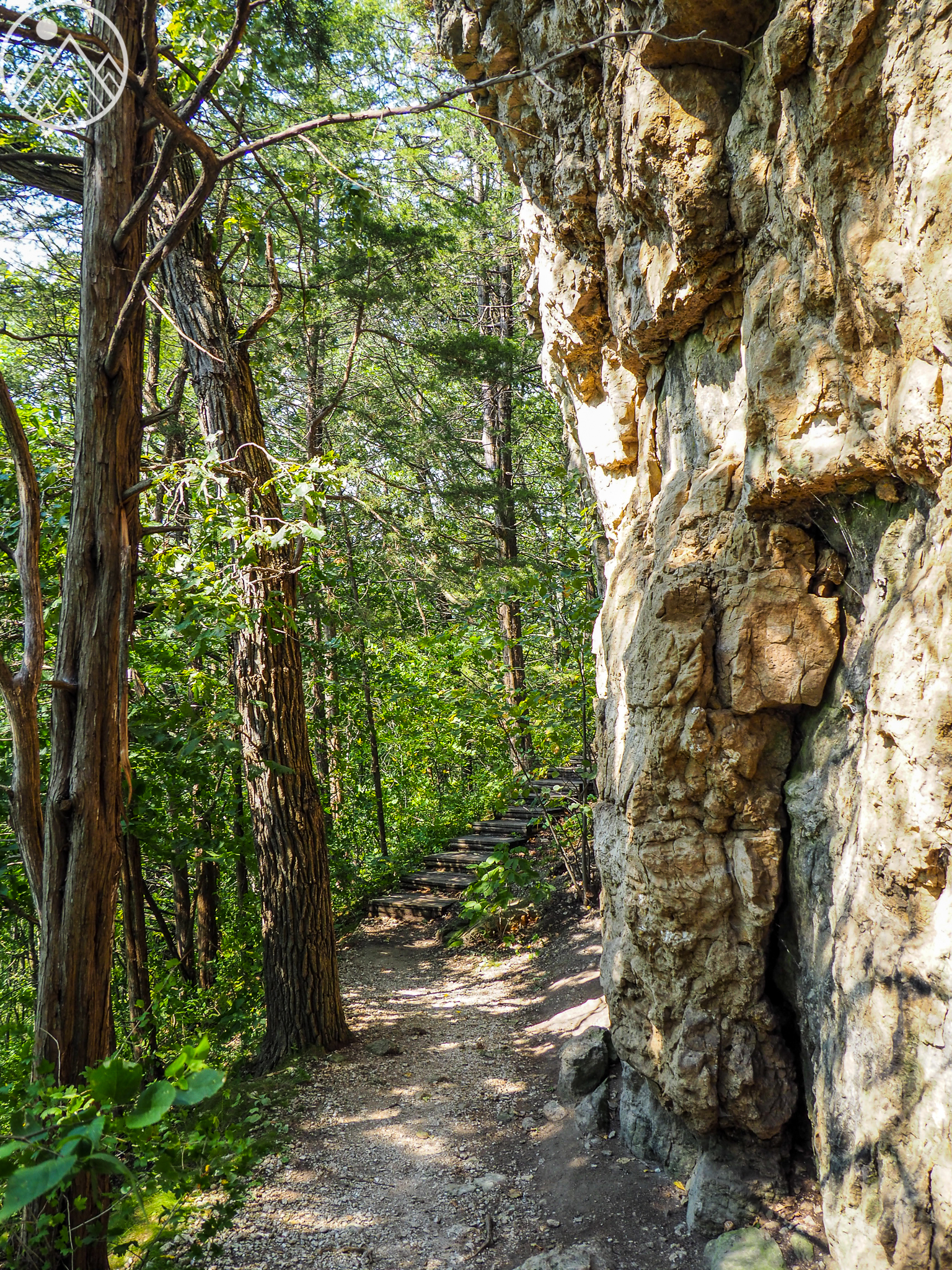
Well up we go, immediately greeted with the hardest part of the trail, a stairway straight up to Coyote Point (this posts featured image) and several beautiful bluffs to take in.
Hitting the point left us hungry so we sat down for some lunch. Ours was an eclectic offering of things we had in the kitchen, hard boiled eggs, rambutans, blue berries, cucumber, turkey and string cheese. Not one of our finest culinary moments but it hit the spot.
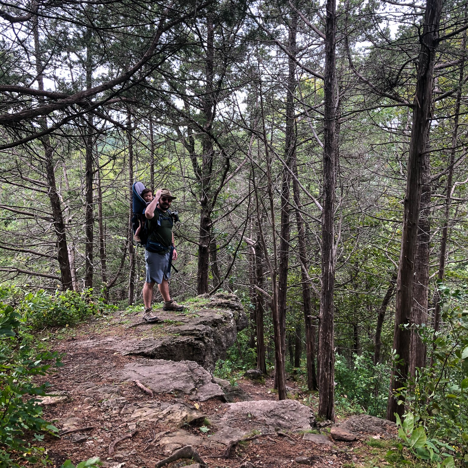

The hike continued after our break but man they weren’t kidding when they said difficult. The trail was very rocky, rooty and steep in places. We really wished we would have brought our hiking poles to keep us stable.
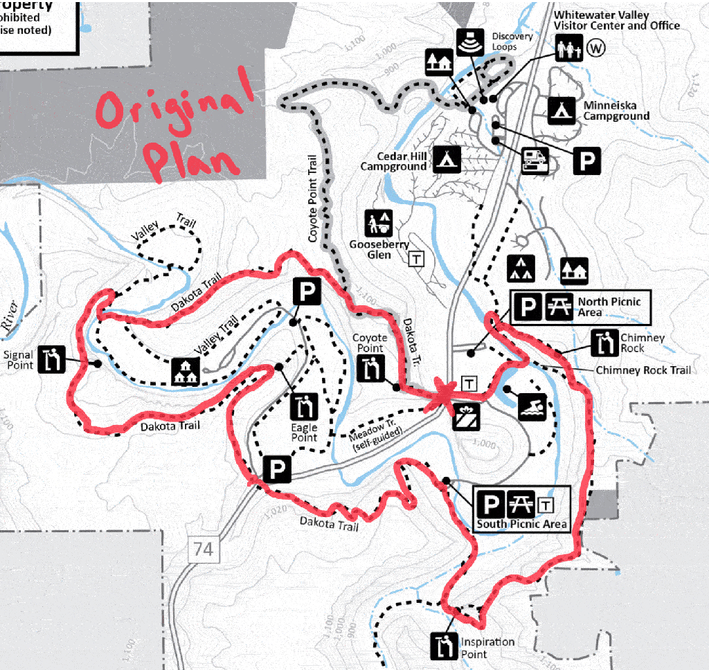
Our hike took an unexpected detour or “bonus trip” as we call them when there was a trail that split off to the right. Xiao argued, that according to our paper map the next split we should take it. Looking at my cached All Trails map I wasn’t so sure (GPS still works without cell service). We decided to take a gamble on it and headed into the woods where the trail got narrower and narrower. I check my phone again and All Trails has crashed, I lost my cached map! But did we stop? Nope! How about when there were fallen logs across the trail? No again! How about branches so low you had to push them out of the way? Nah! We continued for our predetermined 10min commitment of trying the trail out. Within 5min we ran into some deer hunting stands… In a park… Hmm this doesn’t seem like the right way… As you can see on the image above we ‘detoured’ our way out of the park. Turning around we made it back to the main trail and continued on until we actually found the right turn we were looking for.
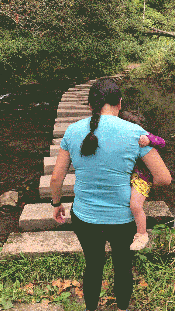
By the time we arrived at Whitewater River it was already 2pm. Clearly our plan of doing the whole Dakota Trail wasn’t going to work, so we enjoyed some time by the stepping stone bridge and planned an alternate route.
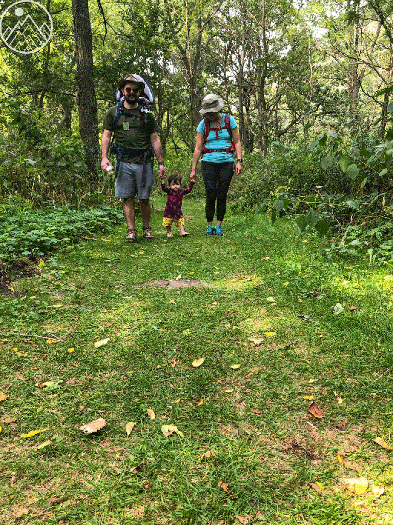
This new plan had us walking eye level with the river and gave us the awesome perspective of the bluffs and ridges we just hiked.

River was full of trout, I’d definitely get a license and bring a pole next time I’m in the area.
We wrapped up the hike through a prairie in autumn bloom while Amelia took some time to stretch her legs after being carted around all day in a backpack.
With our hike done we stopped in Rochester, MN for some much deserved Ice Cream at Flap Doodles. Not too far out of the way if you are headed to the metro and well worth it for the awesome ice cream they have!

